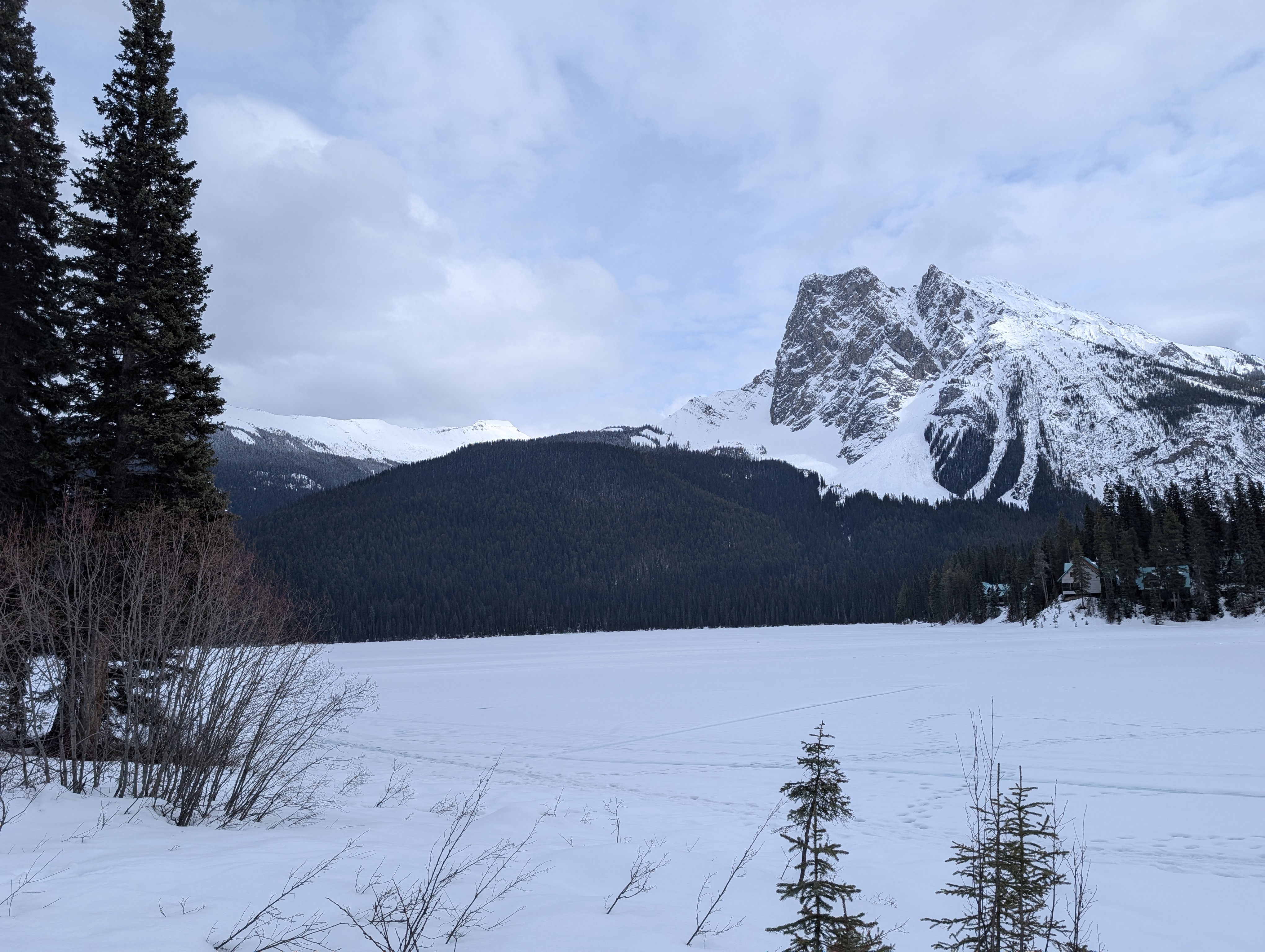
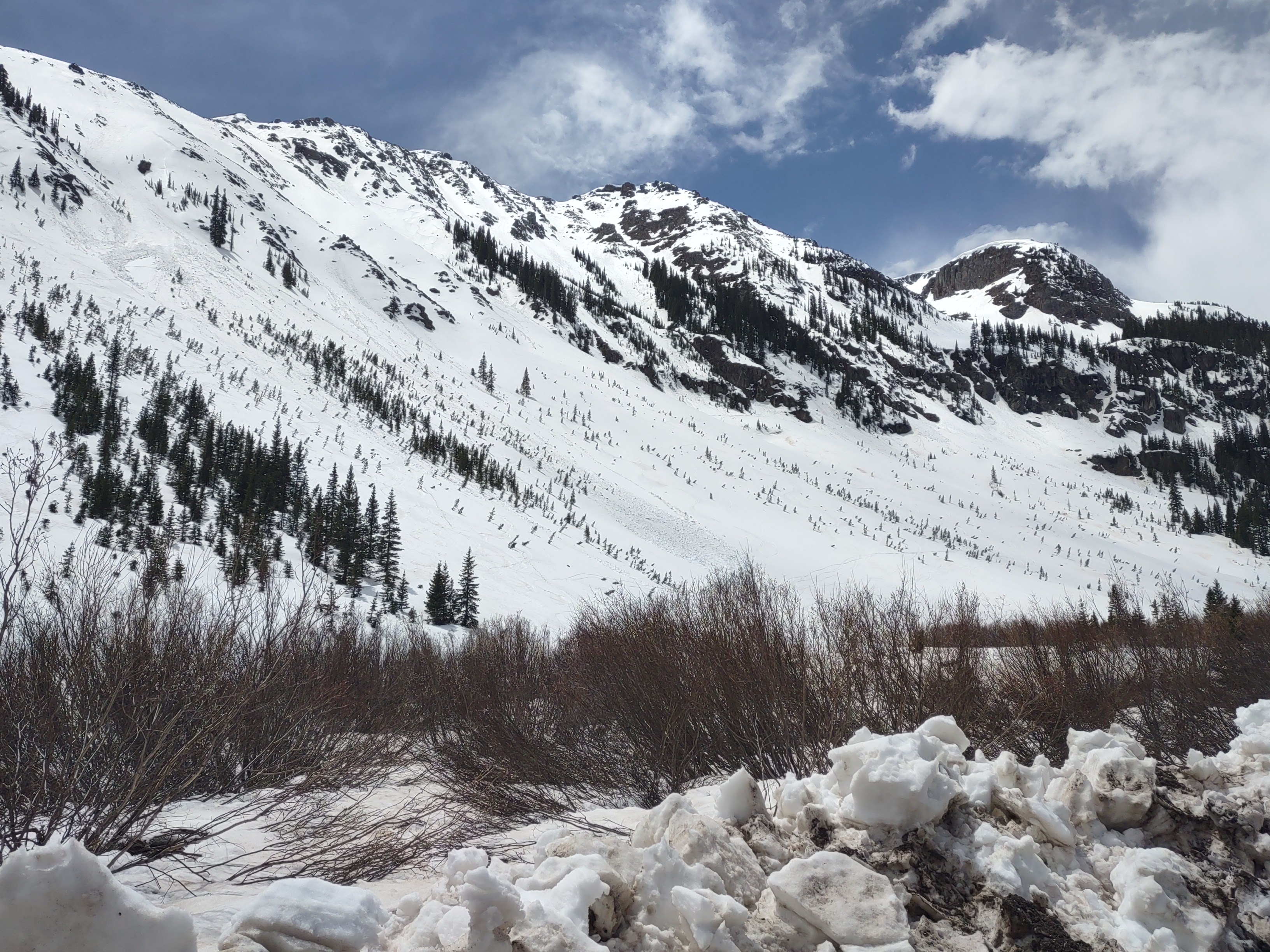
I am not in the habit of writing about trips that i go on, but i would like to change that, if no one else than simply for myself, so… here it goes…
Those who have spent enough time around me have heard that i have this idea: its healthy for us to experience a good epic every once in a while, no not the kind that threatens life or limb necessarily. It could be as simple as dropping into the wrong drainage (take a left at the lone pine and follow the rocky drainage, i mean how can you get that wrong?!?) that results in something unplanned. It leads us to solve problems but with real consequences, it keeps us humble, it makes us learn, but most importantly, it pushes the reset button on life. All of the problems i was dealing with before at work, trying to deal with friends, or in the dating world (ugh... utah...), they just kind of melt away and we become more basic, instinctual, animalistic beings; we get a more visceral sense of who we really are and what really matters. I mean right now, as i type this, i am sitting in a room, its pleasant, i have easy access to essentially unlimited clean water and food; i am in no way working just to stay alive. Through this blog, i will start by describing some of the (limited) experiences i have had, maybe others will learn from my mistakes, maybe they will just laugh at them, i don't care.
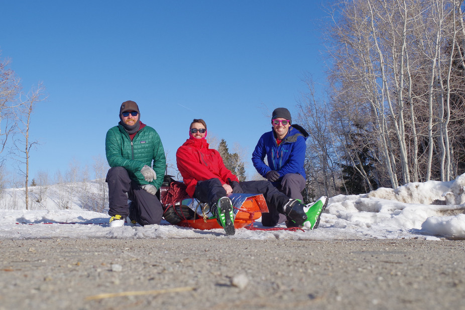
I am not a professional, I am not sponsored, I can't afford to fly into the remote, amazing places for inspiring objectives that you see in national geographic, however i would love to do that someday. Instead i am just a regular 9-5er (i wish... more like 7:30 to 5:30+) who tries hard on the weekends. I am not a professional but i can still find a remote and worthy objective to obsess over, to push myself on, to find my limits, somewhere where i can get way out there away from the alerts and notifications that plague everyday life, somewhere that i can go to feel the primal force of nature and question everything. I think i have recently found that place, or rather, that range. As with so many before me, the Wind River Range has become a bit of an obsession for me recently. My first trip was in September of 2017; an attempt on Gannett peak. I thought for sure that i was strong enough to complete the entire 45 mile round trip in 3 days, but due to some poor routefinding on my part on summit day, i failed to even get close. I returned to the range four months later with the hopes of scouting the area for some potential winter objectives, as i was sure the range had some amazing potential for first ascents/descents. Something that i would soon become aware of, the wind river range doesn't let those who are unprepared pass through lightly. On that scouting mission, we hardly made it halfway through the approach before hitting the limit, absolutely gassed. I knew i had to get stronger to be successful in a range like this. Two weekends ago we returned, with a third, a more refined gear list with a vital few additions (more on that later) and more importantly: more time. The group (below) was psyched for the trip, i mean how can you not be we are going somewhere amazing to do some crazy things!
Strapping in
We left Pinedale a bit later than i wanted to; we were finally packed and walking in at around 9 am. We had a long day of walking ahead of us. The goal was between Seneca and Island lakes, about 12-14 miles from where we started, but a good chunk of the 18-20 miles we had to go to set up basecamp in Titcomb basin. Andy had scouted the approach…. To the trailhead. Yep we had to walk 4 miles just to get to the trailhead. Gotta love winter approaches. On his way in the day prior, he had run into a group of three exiting the range, apparently they had hoped to traverse the range from Pinedale to Dubois (a west to east traverse of about 45 miles cresting over Bonny pass at 12500 feet). They had only made it to Hobbs lake in a day and a half before turning around and coming back; Hobbs lake was 2 miles short of Seneca lake, our minimum day 1 objective, hmm….
Day 1 actually went relatively smoothly, except for the fact that the sled didn't stay upright. Hot tip: if you overload a sled, it prefers to ride on its side or upside down. The sled soon garnered the endearing name of “Goddammit” as it was in the habit of flipping over every 50 feet if you weren't watching, resulting in the exclamation “goddammit not again!” In the end, we got everything figured out and managed to get it to track well and slide upright, however that was with a fair deal less weight and a lower center of gravity. Next time i would take two sleds, each with less weight, to better distribute the load and prevent tipping. Moving on… sometime around 4 or 5 we hit Eklund lake just past photographers point. At this point we were going to deviate from the standard summer trail, which incurs an extra 1.5k vert down and up en route to Seneca lake (vertical movement is a bitch and a half with a heavy sled, the sled is easy to walk with on flat or low angle terrain, but when it gets over about 5 degrees the sled becomes a burden); we thought we could shave some of that vert by linking lakes at the recommendation of the guy at the local gear shop. Upon further investigation though, i decided we might even deviate from his designated route to save the same vert and shave off a mile. At this point the rest of the group was looking pretty gassed though, i mean we had already gone 10 miles. We decided to set up camp about 1 mile short of my Seneca lake goal, but were treated to an amazing sunset over the central core of the range and some delicious salmon pasta.
Day 2: The team woke up feeling strong and ready to push to Titcomb (about 8-10 more miles). I took the lead because we had about 1.5 miles of intense rout-finding to find the best (aka flattest) way through some hilly terrain, seen in the foreground of the above picture, before hitting Seneca lake. Once we hit Seneca lake, a major milestone in my mind, we would be over halfway and navigation would be relatively easy. I spent the morning hitting various high points to find a solid way for the sled to navigate through the terrain, and we made it to Seneca relatively without issue. At Seneca lake, the trail changes character: it goes from endless forest with little to look at, to amazing sweeping mountain dominated landscapes, dotted with amazing skiing and climbing objectives, but relatively few trees or shelter. Seneca itself is great for sled hauling; the lake is 1.5 miles long, directly in the direction that we want to go, and most importantly: perfectly flat. After that, the trail rises over a pass: time to kick it into low gear, rev the engine, and set off! Yep this was my section to haul the sled, and yes, i literally made truck noises as i engaged in a “hill start” towing the sled. I felt like a semi truck, slowly lumbering up hill, what i can say about it: its f’ing hard work! Island lake came quickly, and is when things start to really ratchet up in intensity, as the higher peaks are starting to close around you and you only have 2-4 miles before hitting camp. After Island, we deviated from the summer trail again, once again linking water features that were long frozen to minimize vertical that we would have to travel. Before i knew it, we hit Titcomb! A welcome greeting into the basin: a sense of vertigo as everything was white. The basin is huge, flat (it is a series of lakes) and has absolutely zero trees, terrain features (in winter they are all covered in snow) or reference points. Hey! Over there looks like a good spot for camp, and i think its off the water?
The expanse was stifling in a way that i had never experienced before, and the endless white and lack of features was blinding. I pulled my hood on just to have some color in my field of view which seemed to help with eye fatigue. We chose to set up camp between lower and upper Titcomb lakes near a small hill, the only terrain feature in the basin. Camp was set by cutting into the solid 5 foot thick wind slab of a snow pack and using the blocks igloo style as bricks to build a wind break wall. I was sure the wind would come whipping up or down the long basin and thought the protection would do us well. The work was actually quite easy and before long, we had basecamp built, complete with a trenched hallway between the bedroom and the kitchen. I was pretty psyched about our basecamp to say the least. Plus, i had gotten a chance to examine some of the snow pack. Good news i guess? It was hard wind scoured slab the whole way down. As long as there wasn't a lurking thin layer of buried surface hoar, we should have relatively stable snow conditions for skiing (so long as the rest of the snowpack was similar), i mean hey, at least there didn't appear to be be a buried layer of depth hoar as i was sure there would be!
Basecamp in a rare moment of sun
Day 3 began much as day the previous day ended, cloudy, low visibility, and flat light. The wind had died down a bit so the group quickly ate and prepped for the day. The goal was to explore upper Titcomb basin, ski the Grand Couloir on Mt Helen, and if time allowed, explore Bonney Pass/Twins Glacier areas. The trek back to Mt Helen, despite the lack of visibility and the cloudy skies, was breathtaking in its grandness. Dwarfed by steep rock walls, 13000+ foot peaks, and large open snow covered expanses in between, it was easy to loose yourself in expanse, to feel small and be humbled by this place. Looking around, steep ribbons of snow seemed to fall off of every peak, major and minor, throughout the basin and beyond. It is likely that only a handful of them have been skied due to the difficult access for this basin and this portion of the range. One could easily spend a decade skiing this area and still have more amazing lines to do; i think this area might become a long term obsession for me.
As was the case back at camp, it was clear that the wind had taken its toll on the snowpack in upper Titcomb; the snow was 1 finger+ wind scoured slab all the way down; at least that meant it was probably safe to ski. Luckily there was about 1-4 inches of fresh wind drift and sastrugi on top of this slab would allow for more pleasant riding conditions. Looking up the chute, the team was amazed at how large and long it appeared to be, a seemingly endless hallway of rock between huge jagged towers reminiscent of a scene straight out of Mordor (maybe Mordor in winter? does Mordor have a winter??). With stoke on the line at an all time high, i took the lead and began setting the booter up the left side of the chute.
The couloir has a few light rolls that prevent you from seeing the full extent of it once you enter. On the way up, i was granted the pleasure of setting nearly all of the 1800ft boot pack; Clayton took a small section in the middle while i fueling up on string cheese and recovering a bit. At around this point, it was clear that the weather was beginning to change. The wind had started to pick up a bit more and we had intermittent gusts blowing up the couloir up to about 40 miles per hour transporting quite a bit of snow with it. Luckily the wind seemed to neither be scouring nor loading the slope, rather it was just moving around the top few inches of snow and seemed to be keeping the surface somewhat "fresh". Somewhere around 12,800ft the team decided we had gone far enough and hunkered down behind probably the only terrain feature that offered any sort of protection in the entire couloir, a buttress of rock that lightly jutted out into the snow a few feet with a solid 3 foot deep trench in the snow immediately next to the wall due to wind. Every terrain feature in the upper wind river range had these moats around or next to walls, boulders, and anything else that dared battle against the savage wind. Here, we found temporary shelter and began the transition. I looked up; we were so close to the top of the chute but the other two were pretty gassed from the ascent and there was no shelter between here and the col. The slope angle had eased a bit from the mid 40's at the beginning to probably mid 30's. I was the only one who had brought ski crampons on the trip. After a quick chat with the rest of the team, we turned on our radios (two beofang high powered radios which proved to be a vital tool on this trip) for better communication and I set off. Up, that is, not down; the transition for Clayton would take a bit, i was in clear sight of the rest of the team and i was confident i would be able to run up the remainder of the slope with skins and ski crampons in relatively little time.
Lungs bursting from my ski-sprint uphill, i crested the 13000 foot mark and realized that the remaining slope was a bit longer than initially expected. What had appeared to be about 200 feet of vert turned out to be about 400, but within about 10-12 minutes of setting out from our small island of relative shelter, i was within about 25 vertical feet of the col, the remaining section was completely wind scoured and peppered with rocks. Had the weather have been better and the team not been waiting on me to return, i would have liked to continue on to the summit. Alas, the weather had been steadily deteriorating. I quickly ripped my skins and it was go time! "Dropping" i called over the radio- the plan was that i would ski past the group and continue down to the next safe zone. Three turns in, my right heel popped out of the binding.
Fuck.
No room for error now, as an arrest would be difficult, possibly dangerous, and we are a long way from any sort of help.
I was not too excited about the prospect of skiing the whole couloir in pseudo tele mode, one heel locked and the other free. I returned to the sheltered spot where Clayton and Andy were still waiting to try and fix it. The cold weather, constant wind, and deepish snow had iced the internals of my heel piece, preventing it from fully locking into ski mode. I tried to use a multi-tool to clear it a bit but didn't have much luck, so i screwed the pins in a bit more in the hopes that making the binding smaller would allow it to stay clamped on my heel. OK, lets try this again - "See Ya" i said to the other two and continued on my way down. This time i made it 10 turns in before my heel popped again. Damn. Well i guess i would just have to ski it safe and slow, re-lock the heel when i could, ride cautiously, and find a safe zone to work on it again. There are several narrow slopes that enter the couloir on skiers left, and a sheer rock wall on skiers right as i descended, the next safe zone wasn't until i was essentially out of the couloir and it took a bit longer than anticipated. The team, still up high and in the heavier winds, were starting to cool off and needed to get going. I heard some yelling over the radio wondering were the hell i was and why it was taking to long. Finally, i got to the end of the couloir and tucked under some rocks and called over the radio that i was safe. Andy and then Clayton both styled the line, making it look amazing and worthy of any Warren Miller or Jeremy Jones flick.
It was only 3 and we still had plenty of "sunlight", but at this point it was very clear that the weather was deteriorating rapidly and we needed to get back to camp, so the decision was made to point tips and straight line it as far as possible back towards camp. Once we hit the bottom of the basin, the mood quickly changed. We were greeted with whiteout conditions, removing our only method of navigation, views of the surrounding peaks as there were no terrain features and relatively few exposed boulders in the bottom of the basin. Winds were easily gusting at 60+, the strange thing was that they were not coming from a defined direction- the wind would go from north, to south, to west, to northeast, to east, and anywhere in between in a matter of a few minutes. It was like walking in a snow globe that someone was constantly shaking around. It was hard to tell if we were moving in the correct direction. Occasionally i would get a quick glimpse of my surroundings, just enough to orient myself and keep the group moving. At times i would think i was skiing downhill, only to look down and realize that i had been standing still for a few minutes because i could see a few grains of snow laying on the ground, still, next to me. We continued to trudge on; the 1.5 mile approach seemed much longer this time around, battling the wind with every step and fighting just to stay on our feet.
Back at camp, we ate, drank, talked, reminisced on the conquest of the day. I went out to take the most strenuous shit of my life thus far. Buffeted by 50 mile an hour snow laden winds, I chimneyed between a rock and the icy wind formed lip was the best shelter i could find for my vulnerable moment. On the positive side, who needs TP when you have 50+ mph winds blasting your ass sand-blaster style? Just kidding... the snow and wind didn't do much to clean so the good old wipe with some TP and burn it method was employed.
Morning on day 4 came with relative calm, this was the weather window day and i was hoping to make an attempt on Gannet. I awoke with a lip that was about 2-3x normal size. "That looks like some kardashian shit" as Clayton so eloquently put it. The general vibe from the group was tired. I felt relatively fine but i figured my body was trying to tell me something: rage a little less hard today, i need to rest a bit. We had a nice leisurely morning making breakfast and prepping for the day. A foot of fresh snow had fallen over night and i was a bit concerned that our exit would be made a bit more difficult and would take longer than we expected. We already had two days budgeted though so i guess that would be enough. Besides, we had fresh snow and some... gasp! SUN! I spent breakfast cooking my skis over the waste heat coming off the stove while we made our actual breakfast (breakfast couscous) to warm them up and clear out any icing that had built up and caused me problems the day before. Mmmm who doesn't love fresh cooked ski for breakfast?? This definitely worked though and my pre-release issues were gone for the rest of the trip. Clayton and i set out to ski some quick shots on the slope just west of camp. The snow was great but, as usual, there was little shelter from wind. Even so, the laps were amazing and we got to ski fall line right to camp. Seeing as it was deemed a "rest day" we only did two laps; i had to reset the uptrack each time due to wind transport quickly erasing any sign that we had been there. The majority of the day was spent eating; at this point it was pretty clear we had brought too much food and we wanted to get rid of as much weight as possible for our return trip.
This is the point when everything changes. We go from "thriving" in this hostile environment to "surviving" at best. This is also the point at which the pictures stop. So from here on out all you get are my descriptions, they'll have to do.
I awake sometime around 3am to Clayton hurriedly rushing to go outside and go to the bathroom. I notice the walls of the tent are bowed in a bit. Not a huge deal yet, the tent is meant for this stuff. He returns simply stating "there is so much snow out there", not in the usual, excited voice, but with a fair amount of concern. I can hear the wind is really raging now. I try to sleep a bit longer. I awake at 5:30am, the tent has significantly shrunk in size now, Andy, Clayton and i are practically spooning. Not great. I gear up to go outside, we need to dig the tent out otherwise it might collapse. I step out into the vestibule, to prevent snow from getting into the tent, prepare myself, open the vestibule and step outside. It is truly astounding how much things have changed over night. Everything is under 3, maybe 3 and a half feet of snow. We are actively being wiped from the face of the earth by this "storm" that wasn't really even in the forecast, and we had been listening to the forecast every morning and night on our beofang radios. I stand up. Its hard for me to describe this feeling, it is unlike anything i have ever felt before. The wind is strong, blowing at 50+ mph, gusting to... i don't know, 70mph? 80? hard to say. There is so much snow in the air that i can't breathe, i can't see, i feel like i am drowning except i am not under water. It isn't enough to breathe through my nose, my body rejects the idea of breath and goes into a sort of shut down mode. I rip my hood over my face so there is a half inch slit open facing straight down, just enough for me to get air through; i wait for the wind to subside enough for me to do anything else. I grab a buff from my pocket and cover my mouth. Better, now i can breathe at least. I start digging out the packs so i can find my goggles to be able to see. With vision restored, i start digging out the tent. I yell to Clayton and Andy that we need to start packing up. I am not sure these kind of conditions are survivable long term based on how we have things set up, we might get buried alive if we wait in the tent for too long. I work for a half hour digging out one half of the tent and move on to the other. By the time i finish, the first section is already under 3 feet of snow again. I repeat, endlessly, while Clayton packs up inside the tent and Andy starts prepping water for the day. We forgo breakfast, we need to get out of there ASAP and have enough snacks to sustain. I continue digging. It is a lot of work but my body is in survival mode and the adrenaline is pumping.
SNAP
FUCK!
The center hoop of the tent folds and snaps cleanly into two pieces. I continue digging, i notice that the fly has multiple tears up to 2 feet long due to the weight of several feet of snow pushing on it.
Not good.
Inside the tent, nothing has had a chance to solidly dry since we began the trip. Sleeping bags are damp due to body moisture, the tent is coated in a layer of condensed breath because we couldn't properly vent without letting in horrendous amounts of snow.
I yell "WE NEED TO LEAVE. NOW."
The tent is cleared of stuff, we throw it all into the miraculously unaffected kitchen tent. We pack. I start taking down the kitchen tent. One of my attachment points wont come loose. I rip the cord attaching it in half because we need to leave. We finally get everything packed, but i realize one of my axes is missing. I really don't want to leave it here buried somewhere in the snow... I do a quick search. If i cant find it in two minutes it gets left. We need to leave. Randomly trenching in the snow with my shovel i strike it. Oh thank god. We strap in and go.
Before the trip i bought a Suunto Ambit Peak3 watch because it has the capability of GPS tracking for up to 200 hours without a charge and has a solid Altimeter/barometer. I think this might have been the single most important piece of equipment for us on this trip at this moment. Before going somewhere, i studiously will stare at the maps for that location, trying to memorize all major and minor terrain features and way points to ease navigation. Later, while "executing" i try to mentally overly that topo mat i have partially memorized onto the land around me to know what is where. I knew on the way out we wanted to follow the water course more closely than we had on the way in. Even more so now that we were breaking trail in 1-2 feet of fresh snow. Compounded by the fact that this place was actively trying to erase us. The only problem was that we were trying to navigate in a white out and i couldn't track terrain features to navigate. Never before have i felt like a place was so actively trying to remove me, like i absolutely 100% didn't belong. If we stopped moving, even for a minute, our tracks were erased, our skis disappeared under the drifting snow, and there were no signs anyone had ever been there other than our bodies which remained defiantly upright. Luckily, using the watch, things went relatively smoothly.
One mile in, we did something i am not proud of. We knew we were moving slow. One way to speed up progress was to drop some weight. We had too much food. We stop, and in a glorious frenzy we tear open packets of dried food and scatter the into the wind. We pack up all of the wrappings because i refuse to pollute this beautiful place anymore than i already have. I made sure we had at least enough food to get us through the day, some egg rolls and plain pasta for dinner, and a breakfast in case we need it. Dumping that food was an absolute release of endorphins. We must have only dropped 5-6 pounds worth, but it was as if a weight had been lifted off my soul, we were lighter, if only slightly, and ready to move on.
I took my turn on the sled. The difference was that i was also navigating, so i was going first and breaking trail. Its ok, i thought, Andy and Clayton need to keep up their strength. Based on the state of our gear, i was fully committed to doing the full 18 miles out in one really long day. I was going to do what i had to to make that happen. If that meant navigating, breaking trail, and hauling the sled, well... that is what i was going to do. Nearing the final rise and drop to island lake, i felt myself beginning to get fatigued. "Shit, not now. This cannot happen this early, we have way to long still to go" i thought to myself. I paused and closed my eyes. The warm glow of the light filtering down through the clouds and gracing my closed eyes reminded me of summers spent on Nauset beach in Massachusetts. The snow laden wind became a stiff sea breeze, containing a little sand that stung, as it always had when i was growing up.
Breathe.
I feel as if i am there. Suddenly it isn't so cold out, i can practically smell the salt in the air, the howl of the wind becomes the crash of the waves. I imagine the sand hitting my face instead of snow, the warm sun on my skin. I savor this moment.
Relax.
Exhale.
I open my eyes, mentally recharged, physically ready to continue.
I resume breaking and hauling.
We push on to island lake.
Reaching island lake was a huge relief for me. I knew that once we were there, even though we still had a substantial amount of distance to go, at the very least there would be trees in which we could seek shelter from the wind if things got bad. I slammed two packs of caffeinated gummies while crossing the lake because i knew my crux was coming up. I would have to haul the sled up a couple hundred vertical feet over the pass to island lake, then again over the pass down to Seneca. Things are moving smoothly now. We seem to have walked out of the weather system. The wind is down to 20 MPH gusting 40, manageable. We have spots of sunlight. I look back and see a hellish storm still raging up in Titcomb. We quickly pass by little Seneca, then Seneca lake, over the pass, link the lakes and return to Eklund where we camped the first night. As a group we decide to commit to getting out that night. We stop at around 4 to finally make some real food and recharge our water supply. I can tell that Clayton isn't running at 100%. The stop causes him to quickly cool down. He decided he cant pause any longer. I state that we need water to continue. We decide that he will turn on his radio and continue, after all this would be the fourth time he had navigated through this terrain and he should be familiar with it. Shortly thereafter i send Andy with the sled to follow. So much for a real meal. I boil a few cups of water and throw them in a Thermos for later and set out to catch up. When we do finally catch Clayton he has started to deviate from our designated path, he is trending downhill, where we cant go. That path leads a long way down to several very large and deep lakes that wont be navigable due to thin ice. Dangerous. I yell for him to stop. He is near enough to hear me luckily. We reconvene. I take the lead, continue hauling the sled. We are getting out tonight, even if that means exiting at 2 am.
We click on headlamps as the sun sets. Navigating by the watch, we find the trail we walked up on. We are so close, but Clayton isn't doing well. He exclaims that he wont be able to make it. Shit. I am committed at this point. All of my clothes are wet with sweat and wont dry out tonight, my boot liners are soaked, my sleeping bag is wet, my pad is literally frozen, two of the three pairs of gloves i have with me are blocks of ice, my jacket is a frozen board, the tent is in shambles. What can i do?
"Well... drop your pack" i said
"I dont want to have to come back and get it" Clayton responds
"I will come back and get it in the morning, its better than dying"
"You aren't coming back to get it in the morning" Clayton can be stubborn at times. Sometimes he can be argued with. It is clear that this isnt one of those times.
... I dont know what to do.
I give Andy the sled, after all we are through the majority of the remaining uphill. From here on out it is flat or down hill for about 7 miles, we just have to go through the motions at this point.
"Give me your pack" I say. I am committed to getting out tonight. Whatever it takes. If i have to carry two packs and haul the sled, i will. We set off again, this time with me carrying two packs. I can see that Clayton is awfully close to his absolute limit. Come on, just a few more hours, minimal effort, and we can sleep in a warm dry bed tonight!
Eventually the call that i was dreading rings out out. Clayton cant go any farther. I can see that he is struggling with every step, its not going to work. Damn. I was really hoping we would make it. I find an alcove in the trees, sheltered from the wind, just large enough to set up the tent. Andy and i get everything set up. Andy fixes the tent Meru style with two ice screws and some duct tape. It will get us through the night. I set up Clayton's sleeping stuff, he is struggling just to stay up at this point. We get him in his bag an warming up. I start to boil water. I want to cook some food but it is already 10pm and one of our fuel pumps on the liquid MSR stove has stopped working. It is going to be a cold night. My hands are too cold to mess with the stove anymore. Andy and i eat some frozen cheese and frozen tortillas. I boil a liter of water. Enough get us through the night. We retire for a long cold night in wet gear.
Some time around 6 we wake up. Clayton has recovered enough to finish the walk out and wants to get going. None of us have had a real meal in over a day and i make it clear that we are cooking some food and boiling some water to recharge before we go. The only problem is, its -5 out and apparently there is a lower temperature limit on the MSR liquid fuel stoves (pro tip: they sell a blue pump-its meant for winter expeditions, i didn't know about it before this trip). Neither of the fuel pumps are working, one wont pressurize, the other will but hemorrhages fuel out of the throttle valve. We would burn everything down if we used it and still wouldn't have fuel or water. Clearly we are below the lower temperature limit for the orings for this pump. Turns out it is also too cold for the jetboil to work, there isn't enough pressure in the Isopro canister ("4 season" fuel... yea right). Luckily this is a problem i can solve! My Whisperlite Universal also accepts propane, except i can accept it as a liquid! I swap out some parts with frozen fingers and we are in business! Before long we are eating butter fried egg rolls, drinking some warm bevies, have water for the trail, and are on our way out! It is a beautiful bluebird day, and the walk out is a blissful stroll through a beautiful forest compared to the day prior. I look back at Titcomb; even though it is bluebird back there i can tell that the winds are still raging. There is a 1000ft tall plume of transported snow rising over the highest peaks. From here it is mostly smooth sailing and before long we are out. One minor hiccup though. Andy and Clayton shattered the sled on the way out and there is a bag of gear still up there that we need to grab. Damn. I was mentally already at wind river brewing, enjoying a beer, decompressing. Now i was strapping back into my skis, dehydrated and hungry. I had one final hurdle to overcome before i could fully put this trip behind me, and what a hurdle it was. Mentally i was taxed, physically i was spent. I was moving really slow, i threw on a Science Friday podcast just to get my mind off things. I found the bag, quickly returned to the cars, and two hours later we were actually enjoying that beer at Wind River, astounded at what we had experienced over the course of the past few days. All of us were beat, physically and mentally. We had come close to the limit, but had returned relatively unscathed, with much that had been learned. I can't wait to return. Next time i will wait for a nice ridge of high pressure and sunny skies though.
ADDENDUM:
So what worked and what didn't?
What worked:
High powered Multi-band GMRS/UHF radios- Two of us had Beofang radios with lapel mics. These worked great for group communication in the Couloir, between Andy at basecamp and Clayton and myself while we were out touring, and between the group if we intentionally split up for whatever reason. My radio also gets FM (entertainment) and you can program in the local NOAA channels for weather updates (ours weren't accurate but i think that has to do with the range not NOAA) plus hours of entertainment listening to the robotic "Voice of the National Weather Service". A side note, in our emergency packet left with several people, we had noted what frequencies we would be monitoring. In the event of a rescue, theoretically SAR would be able to jump on that band and communicate directly with us immediately, definitely an added bonus. The batteries for both radios (i had the BF-F8HP) were more than adequate without a charge
GPS Watch- I had a Suunto Ambit Peak3. One of the reasons I chose this particular model over the fancy ones with touch screens and color displays is that it can GPS track for 200 continuous hours without a charge, plus it has a dedicated altimiter/barometer. The tracking was super helpful for navigating through terrain quickly in white out conditions. You can plot your old track (sans topo lines) and then "track back" on it and it will plot your location with respect to that line and your distance from it. Plus, the watch lasted all 6 days on a single charge while tracking each day.
Kitchen Tent- I got a Mountain Smith tarp tent that is put up with ski poles for the kitchen tent. It was definitely nice to have a spot to go and cook, plus it stayed remarkably warm in the kitchen tent when the winds were raging outside. Combine this with a USB LED string that Clayton got on Amazon for like 8 dollars and we were living in luxury in there. We had two recliner seats, a table, two stand up cooking areas, a few shelves, and a third seat. Next time we would make the entrance door a bit smaller so we can use the sled as a hard door to keep out drifting snow.
Snow Saw- I brought this for snow evaluation, however it was very helpful in making snow blocks to build up our fortifications against the wind
Thermos-It is nice to be able to have hot liquid on demand, whether that be for warm beverages, melting more snow for water, or whatever else. I would boil some water the night before and the next morning it was still nearly boiling. We could wake up to hot bevies while we boiled water for food and the day.
What didn't work-
Red MSR fuel pump- the rubber materials are not rated for extremely cold weather. Even though they are "all season" they clearly don't work reliably when it is too cold. For every night except for the first and the last, the Stove was kept in the kitchen tent which was quite a bit warmer than the outside temp. For the last night, this became a problem. I will be investing in a blue pump for future winter specific expeditions
Our snow wall- Even though this did an amazing job at protecting from wind, it was a trap for drifting snow. We had snow accumulating at well over 3 feet an hour due to wind. I am not sure what i would do different. The only thing i can think of is to scrap the whole tent and build a quincy. I am not sure the snow pack was deep enough for this. Maybe? Plus we definitely would have been completely sealed in by the drifting snow If anyone has suggestions on how to deal with this issue, i would love to hear them.
Sled- This was our own fault, i have two sizes, we should have brought the bigger one, or brought two. We put too much stuff on it. Noted for next time.
Soft-shell or leather gloves- These gloves get wet. They definitely have their place, but my ideal glove system would probably change. Next time i would definitely bring some rubber cold weather fish processing gloves (i have a pair, i was stupid to not bring them) because they wont wet through. That way you can handle snow as much as you want (you definitely will have to at some point) and not worry about getting gloves wet. I would bring those, a thin-ish climbing soft-shell liner glove, and a large mitt that can fit over the soft-shell glove.